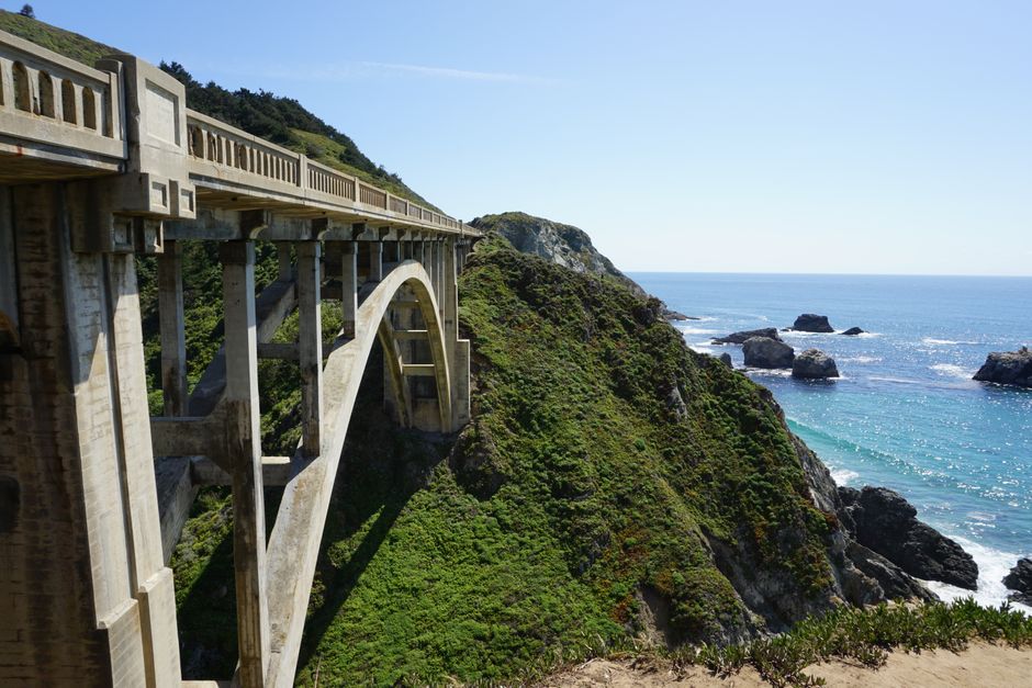
Driving the Pacific Coast Highway: Essential Stops and Tips
Driving the Pacific Coast Highway, often referred to as Highway 1, is a journey that combines dramatic coastal landscapes with the practicalities of road travel. The route stretches along California’s shoreline, offering a series of viewpoints, small towns, and natural attractions that draw visitors from around the world. Planning this drive involves understanding not only the scenic highlights but also the logistics of fuel, accommodations, and the varying conditions that arise with the seasons. A well-prepared traveler can focus on the experience rather than unexpected challenges.
This guide outlines the essential stops, fuel considerations, and seasonal traffic patterns that shape a Pacific Coast Highway journey. It emphasizes a process-oriented approach: identifying key segments, understanding fuel availability, and anticipating how weather and peak travel times may influence the pace of the drive. The information is intended to support informed decision-making and flexible planning, recognizing that road conditions, personal preferences, and external factors all play a role in the overall experience.
Whether you are considering a full end-to-end drive or a shorter segment, the principles remain similar. The goal is to provide a framework for organizing the trip, highlighting the importance of preparation and adaptability. The following sections explore the route’s geography, notable stops, fuel and service access, and the seasonal rhythms that affect traffic and accessibility. Each aspect is presented with an emphasis on context and methodology, rather than prescriptive advice.
Understanding the Route and Its Segments
The Pacific Coast Highway is not a single, uniform road but a collection of segments that vary in character, accessibility, and surrounding infrastructure. From the southern gateway near San Diego to the northern terminus in Mendocino County, the highway passes through diverse environments, including urban stretches, agricultural plains, and rugged coastal cliffs. Each segment has its own pace and set of considerations, and understanding these differences is foundational to planning a drive that matches your interests and available time.
Travelers often divide the route into logical sections, such as the southern coastal stretch from San Diego to Los Angeles, the central coast from Los Angeles to Monterey Bay, and the northern redwood coast. This segmentation helps in allocating time, identifying fuel and service points, and anticipating traffic patterns. For instance, the southern portion may involve heavier urban traffic and more frequent exits, while the central and northern sections offer more remote stretches with fewer amenities. Recognizing these contrasts allows for a more realistic itinerary.
The highway’s alignment with the coastline means that weather and road conditions can change quickly. Fog, rain, and occasional landslides are part of the region’s natural patterns, particularly in the northern sections. Planning should account for potential delays and the possibility of temporary closures. Checking official road condition resources before and during the drive is a routine step that can help avoid unexpected disruptions. Flexibility in scheduling is a practical approach when navigating this dynamic environment.
Essential Stops and Viewpoints
Along the Pacific Coast Highway, certain stops have become well-known for their scenic or cultural value. These locations are not mandatory but often serve as natural break points and provide context for the journey. One such area is the Big Sur coastline, where the Santa Lucia Mountains meet the Pacific. Here, pullouts and vista points offer opportunities to observe the landscape, and the absence of widespread commercial development contributes to a sense of remoteness. Travelers should note that parking at popular viewpoints can be limited, and respecting posted signs and private property is part of responsible travel.
Further south, the stretch between Santa Monica and Malibu combines coastal views with easy access to services. This area may suit those who prefer shorter drives with frequent stops. Moving north, the Monterey Peninsula and the 17-Mile Drive offer a mix of coastal scenery and forested areas, though the latter is a private road with an entrance fee. The Piedras Blancas elephant seal viewing area near San Simeon provides a seasonal wildlife observation point, with boardwalks and interpretive signs. Each stop has its own character and practical considerations, such as parking availability and seasonal crowding.
-
Big Sur: Iconic cliffs and limited services; plan fuel and supplies in advance.
-
Pfeiffer Beach: Known for its unique rock formations; access via a narrow road, check conditions.
-
McWay Falls: A short walk from the highway to a viewpoint overlooking a waterfall.
-
Santa Barbara: A good midpoint for exploring local architecture and refueling.
-
Redwood National and State Parks: Northern extension with old-growth forests and coastal access.
When selecting stops, consider the time of day and the direction of travel. Many travelers prefer to drive north to south to keep the coastline on their right, which can be more convenient for pullouts. However, this is a personal preference, and both directions offer distinct perspectives. It is also worth noting that some attractions may have seasonal access restrictions or require advance reservations, so verifying current conditions is a sensible step before arrival.
Fuel, Services, and Practical Logistics
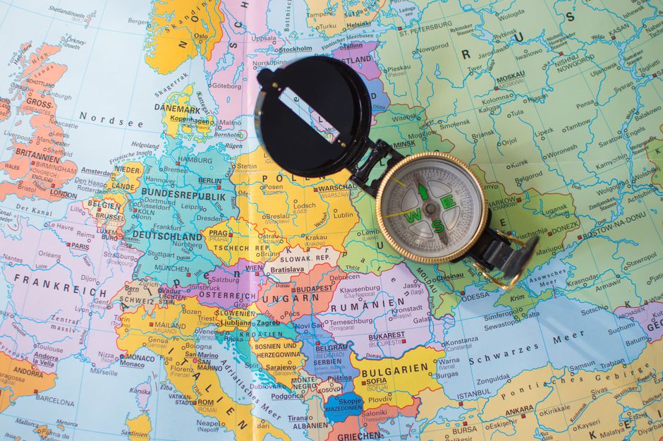
Fuel availability along the Pacific Coast Highway varies significantly by segment. In urban areas and larger towns, gas stations are plentiful, but in remote stretches such as Big Sur, services are sparse and prices may be higher. A general practice is to refuel before entering long stretches without stations, particularly if driving a vehicle with limited range. Carrying a physical map or downloading offline maps can be useful in areas with weak cellular coverage, as signal strength can be inconsistent along the coast.
Beyond fuel, travelers should consider access to food, water, and restrooms. Some segments offer few options, and businesses may have limited hours, especially outside peak seasons. Planning meal stops around towns with known services can reduce stress. Additionally, vehicle maintenance should be checked before the trip, including tires, brakes, and fluid levels, as the route includes winding roads and steep grades. Emergency supplies, such as a flashlight, first-aid kit, and extra water, are standard precautions for road trips in remote areas.
Overnight accommodations should be booked in advance, particularly during popular travel periods. Campgrounds and hotels in high-demand areas may fill up months ahead. For those traveling with pets, verifying pet policies is important. The Pacific Coast Highway passes through several jurisdictions, each with its own regulations regarding parking, camping, and roadside stops. Familiarizing yourself with these rules contributes to a smoother journey and helps preserve the environment for others.
Flexibility and preparation are central to a comfortable drive; conditions can change, and having contingency plans supports a more predictable experience.
Seasonal Traffic Patterns and Weather Considerations
The Pacific Coast Highway experiences distinct seasonal variations in traffic and weather. Summer months, particularly July and August, bring the highest volume of visitors, leading to congestion in popular areas and increased demand for services. Spring and fall often offer milder weather and fewer crowds, though some businesses may operate on reduced schedules. Winter can bring rain and occasional road closures, especially in the northern sections, but also provides opportunities for quieter drives and dramatic scenery. Understanding these patterns helps in choosing a travel window that aligns with personal preferences for weather and crowd levels.
Weekday travel is generally less busy than weekends, and early mornings are often quieter than afternoons. Local events, holidays, and school breaks can also influence traffic. Monitoring traffic apps and official highway resources can provide real-time information, allowing for adjustments to the day’s plan. It is worth noting that fog is common in summer along the central coast, which can reduce visibility and slow driving speeds. Allowing extra time and using headlights appropriately are standard responses to these conditions.
Construction and maintenance work may occur during certain seasons, leading to lane closures or detours. Checking the California Department of Transportation (Caltrans) website before departing can alert you to planned works. Additionally, natural events such as landslides or winter storms can cause temporary closures. Having alternative routes in mind, such as inland highways, can be a practical contingency. The key is to remain adaptable and to prioritize safety over strict adherence to a schedule.
Planning for a Balanced Experience
A successful Pacific Coast Highway drive is often the result of balancing scenic exploration with practical logistics. Setting a realistic daily mileage that accounts for stops, traffic, and weather is more sustainable than trying to cover too much ground. Many travelers find that limiting driving to a few hours per day allows for deeper engagement with each area. This approach also reduces fatigue and supports safer driving, particularly on winding coastal roads.
Creating a loose itinerary with identified priorities—such as specific viewpoints, short hikes, or towns of interest—can provide structure without being overly rigid. Reserving accommodation in advance for key overnight stops is advisable, while leaving some flexibility for spontaneous discoveries. Travelers should also consider the environmental impact of their visit, following leave-no-trace principles and respecting wildlife and local communities. Open Road Journal emphasizes that road travel is a dynamic process, and the most rewarding journeys often include room for adjustment and learning along the way.
Finally, documenting the trip through notes or photographs can enhance the experience and provide a record of the journey. Sharing information with fellow travelers, such as updated fuel availability or road conditions, contributes to a community of informed road users. By approaching the Pacific Coast Highway with preparation, respect for the environment, and a flexible mindset, travelers can navigate this iconic route with greater confidence and appreciation for its unique character.